


East Beach Norfolk Flood Zone and Insurance Guide: What Every Buyer Needs to Know
If you are seriously considering buying a home in East Beach, flood zone status belongs in your first conversation — not your last. This is a Chesapeake Bay waterfront community and the flood zone designation for any specific property directly affects what you will pay for flood insurance, whether it is required at all, what your lender will mandate, and what your long-term ownership costs look like.
This guide explains the FEMA flood zone system as it applies to East Beach specifically, what the different zone designations mean in practical terms, how to look up any individual property, and what buyers need to do before making an offer.
Why Flood Zones Matter in Norfolk
Norfolk faces some of the highest rates of relative sea level rise on the East Coast — a combination of warming oceans and natural land subsidence in the region. The City of Norfolk has acknowledged this reality directly and is actively partnering with the US Army Corps of Engineers on a major flood mitigation infrastructure project, including tide gates, levees, pump stations, and nature-based shoreline features. That project represents one of the most significant flood infrastructure investments in city history.
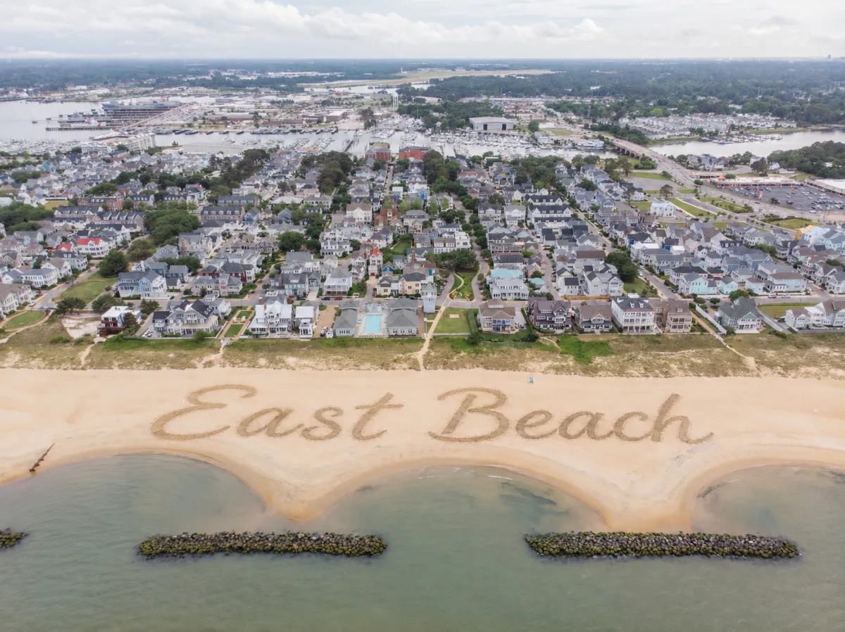
Understanding this context matters for East Beach buyers. The neighborhood itself was engineered with flood mitigation built into the design — offshore breakwaters stabilize the shoreline, native dune planting protects the beach walkovers, and the elevated construction standards of the post-2004 build environment are meaningfully different from the older housing stock in surrounding Norfolk neighborhoods. But East Beach is still a Chesapeake Bay waterfront community and flood zone designations are a real factor in the ownership equation.
The FEMA Flood Zone System Explained
FEMA designates flood zones on Flood Insurance Rate Maps that identify areas by their annual flood risk probability. The most common flood zone designations in Norfolk — and in East Beach specifically — are Zone VE, Zone AE, and Zone X.
Zone VE is the highest-risk coastal flood designation. VE stands for Velocity zone with wave action — properties in Zone VE face the 1 percent annual chance flood hazard combined with significant wave action of 3 feet or more. In East Beach, bayfront properties directly on the Chesapeake Bay are most likely to carry a Zone VE designation. Zone VE properties with federally backed mortgages are required to carry flood insurance, and premiums are typically the highest in the zone hierarchy because wave damage compounds the risk beyond still-water flooding. Zone VE properties are also subject to stricter building code requirements including elevated foundation standards.
Zone AE is the second-tier high-risk designation. AE stands for areas inundated by the 1 percent annual chance flood — commonly called the 100-year flood — for which base flood elevations have been determined. Wave action in Zone AE is less than 3 feet. In East Beach, many bay-adjacent and near-bay properties carry Zone AE designations. Like Zone VE, Zone AE properties with federally backed mortgages require flood insurance. Premiums are generally lower than Zone VE but still represent a meaningful carrying cost depending on the property's specific elevation relative to the base flood elevation.
Zone X is the lower-risk designation for areas outside the 100-year flood boundary with reduced flood hazard. In East Beach, some interior properties and elevated lots carry Zone X designations. Flood insurance is not federally required for Zone X properties with government-backed mortgages, though the City of Norfolk and FEMA both recommend flood insurance for all properties given Norfolk's coastal flood environment. Approximately 25 percent of all National Flood Insurance Program claims nationally come from Zone X properties.
How to Look Up the Flood Zone for Any East Beach Property
There are three reliable tools for looking up the specific flood zone designation for any individual East Beach property:
The City of Norfolk's Forerunner tool is the most accessible starting point for Norfolk properties. It is a public website that allows homeowners, buyers, insurance agents, and real estate professionals to access flood risk data for individual Norfolk properties by address. It is available through the City of Norfolk's flood zone information page.
The Virginia Flood Risk Information System operated by the Virginia Department of Conservation and Recreation allows users to enter any Virginia address and retrieve the FEMA flood zone designation, SFHA status, and FIRM panel information for that location. It pulls directly from FEMA's National Flood Hazard Layer.
The FEMA Flood Map Service Center at msc.fema.gov is the official federal source for flood hazard mapping products. You can search by address to find the official Flood Insurance Rate Map for any property and confirm the zone designation directly.
For specific flood zone determination letters — which mortgage lenders typically require — the City of Norfolk Planning Department processes requests within two business days and can be reached at 757-664-4752.
The Elevation Certificate and Why It Matters
An elevation certificate is a document prepared by a licensed surveyor that provides specific elevation information about a building — its location, lowest floor elevation, and flood zone. For properties in Zone VE or Zone AE, an elevation certificate is often the single most important document in determining flood insurance cost.
The relationship between a home's lowest floor elevation and the base flood elevation for its specific zone determines the flood insurance premium. A home with a lowest floor above the base flood elevation will pay significantly less for flood insurance than a comparable home below it. In East Beach, where homes were built post-2004 to modern construction standards on a master-planned footprint, many properties have favorable elevation relative to their base flood elevation — but this is property-specific and cannot be assumed.
Buyers of East Beach properties in Zone VE or Zone AE should request the existing elevation certificate as part of due diligence and use it to get a specific flood insurance quote before committing to a purchase. Do not rely on estimates or general figures — the variance between properties can be substantial.
What Flood Insurance Actually Costs in East Beach
Flood insurance for East Beach properties is available through the National Flood Insurance Program and through private flood insurance carriers. NFIP premiums are calculated based on zone designation, base flood elevation, the building's lowest floor elevation relative to that elevation, the year the structure was built, and the coverage amount selected.
FEMA introduced the Risk Rating 2.0 methodology in 2021 which bases premiums more directly on individual property risk characteristics rather than flood zone alone. This has increased premiums for some properties and decreased them for others, depending on the specific risk profile.
For a general planning framework: Zone X properties where flood insurance is voluntary may pay between $400 and $800 per year for a basic NFIP policy. Zone AE properties with favorable elevation certificates may pay between $800 and $2,500 per year depending on elevation differential and coverage amount. Zone VE properties typically carry the highest premiums — often $3,000 to $8,000 per year or more depending on elevation, coverage, and specific risk characteristics.
These are planning ranges only. The only accurate number is a quote obtained for the specific property using the actual elevation certificate. Buyers should obtain this quote before making an offer, not after going under contract.
East Beach's Built-In Flood Mitigation
It is worth noting that East Beach was engineered with meaningful flood mitigation built into the neighborhood design — a distinction that matters when evaluating waterfront properties in Norfolk broadly.
The offshore breakwater system stabilizes the shoreline and reduces wave energy reaching the beach walkovers and bayfront properties. Native sand dune restoration and coastal planting protects the beach profile. Every home was built after 2004 to modern construction standards that include elevated foundations on bayfront properties. The neighborhood's engineered stormwater system was designed as part of the master plan rather than retrofitted. These features do not eliminate flood zone designation or flood insurance requirements, but they do reflect a level of flood risk engineering that older waterfront neighborhoods in Hampton Roads do not have.
What Buyers Should Do Before Making an Offer
Verify the specific FEMA flood zone for the property using the City of Norfolk's Forerunner tool or the Virginia Flood Risk Information System. Do not assume based on general proximity to the water.
Request the elevation certificate from the seller or listing agent as part of due diligence. If one does not exist, budget for a licensed surveyor to prepare one.
Obtain a flood insurance quote using the elevation certificate before finalizing your offer. Factor the annual flood insurance premium into your total monthly carrying cost calculation alongside mortgage principal, interest, property taxes, homeowner's insurance, and HOA fees.
Discuss flood zone implications with your lender early in the process. If you are using a VA loan or any federally backed mortgage product, your lender will require flood insurance for Zone VE and Zone AE properties. Understanding this requirement before you are under contract avoids surprises.
Consider private flood insurance as an alternative or supplement to NFIP coverage. Private carriers have become increasingly competitive in coastal Virginia markets and may offer lower premiums or broader coverage for specific property profiles.
Frequently Asked Questions About East Beach Norfolk Flood Zones
Is East Beach Norfolk in a flood zone?
Parts of East Beach are in FEMA-designated flood zones. Bayfront properties directly on the Chesapeake Bay are most commonly in Zone VE or Zone AE — high-risk designations. Interior and elevated properties may be in Zone X — the lower-risk designation. The specific flood zone for any individual property must be verified using the FEMA Flood Map Service Center, the City of Norfolk's Forerunner tool, or the Virginia Flood Risk Information System.
Is flood insurance required for East Beach homes?
Flood insurance is required for federally backed mortgages on properties in Zone VE or Zone AE. It is not federally required for Zone X properties, though the City of Norfolk and FEMA recommend flood insurance for all properties given the coastal flood environment. VA loans on Zone VE and Zone AE properties require flood insurance as a condition of the loan.
How do I find the flood zone for a specific East Beach property?
The most accessible tools are the City of Norfolk's Forerunner tool available through the City's flood zone information page, the Virginia Flood Risk Information System at the Virginia Department of Conservation and Recreation website, and the FEMA Flood Map Service Center at msc.fema.gov. For an official flood zone determination letter, contact the City of Norfolk Planning Department at 757-664-4752.
What is an elevation certificate and do I need one?
An elevation certificate is a document prepared by a licensed surveyor that records a building's specific elevation relative to the base flood elevation for its flood zone. For Zone VE and Zone AE properties, the elevation certificate directly determines flood insurance premium. Buyers should request the existing elevation certificate as part of due diligence and use it to obtain a specific flood insurance quote before making an offer.
Does Norfolk's sea level rise affect East Beach?
Norfolk faces among the highest rates of relative sea level rise on the East Coast. The City is actively partnering with the US Army Corps of Engineers on a major flood infrastructure project to address long-term coastal flood risk. East Beach was engineered with offshore breakwaters, coastal dune restoration, and modern elevated construction standards that reflect a higher level of flood risk mitigation than older waterfront neighborhoods. Buyers should factor long-term sea level rise into their evaluation alongside current FEMA flood zone designations.
All flood zone information should be verified for individual properties using official FEMA and City of Norfolk tools. Flood insurance requirements and costs vary by property. Information in this post is for general educational purposes and does not constitute legal, financial, or insurance advice. Flood zone designations are subject to change with FEMA map updates. All real estate transactions are subject to fair housing laws. John King and Berkshire Hathaway HomeServices RW Towne Realty are equal opportunity housing providers.
About the Author
John King is a Navy veteran and licensed real estate agent with Berkshire Hathaway RW Towne Realty, serving Hampton Roads including Virginia Beach, Norfolk, and Chesapeake. Known for his straightforward approach and market expertise. 📞 757-270-3994 📧 [email protected] 🌐 www.757King.com
Curious what your home is worth in today's market? Get a free home valuation and find out where you stand.


Innovation
Fresh, creative solutions.

Integrity
Honesty and transparency.

Excellence
Top-notch services.

FOLLOW US
COMPANY
CUSTOMER CARE
LEGAL
Copyright 2026 John King | KingRealtor757. All Rights Reserved.